PostgreSQL-specific Geography Tasks
Description
PostreSQL examples for database creation, creating and dropping tables with geometry columns, inserting location data values, inserting line data values, and polygon data values.
PostGIS Support for PostgreSQL
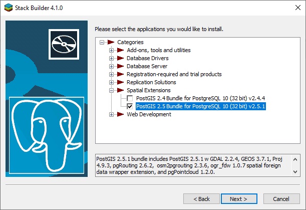
Before you can use geography functions with your PostgreSQL database, you must install the PostGIS support. You can do this using the Stack Builder that is installed with PostgreSQL. Run the Stack Builder, select Spatial Extensions and then check the version you want to install. Follow the instructions to install the PostGIS Bundle.
Database Creation
For the current version of PostgreSQL as of this writing, you must install one or more of the following extensions. You can do this with pgAdmin4 or from Xbasic after you create the database. Install the extensions by executing the following SQL in a query window.
CREATE EXTENSION postgis;
CREATE EXTENSION postgis_topology;
CREATE EXTENSION fuzzystrmatch;
CREATE EXTENSION postgis_tiger_geocoder;
CREATE EXTENSION address_standardizer;
Database Creation
For older versions of PostgreSQL the database must be created from the template "template_postgis".
CREATE DATABASE myDB WITH OWNER myowner
    TEMPLATE = template_postgis;
Creating and Dropping Tables with Geometry Columns
Creating a table with geometry columns:
CREATE TABLE "GeogTest"
(
"KeyValue"	varchar(25)	NOT NULL,
PRIMARY KEY ("KeyValue"))

SELECT AddGeometryColumn('GeogTest', 'Location', 4326, 'GEOMETRY', 2);
Dropping a table:
SELECT DropGeometryColumn('mygeometrytable', 'geomcolumn');
DROP TABLE "GeogTest"
Inserting Location Data Values
Inserting location data using Portable SQL Syntax:
INSERT INTO GeogTest (KeyValue, Location)
    values('Item1', GeogCreateLocation(-70, 42, :SRID))
Inserting location data using Native syntax:
INSERT INTO "GeogTest"  ("KeyValue", "Location")
    VALUES ('Item1', ST_GeometryFromText('POINT(' ||
    CAST( - 70 as VARCHAR(1024)) || ' ' ||
    CAST(42 as VARCHAR(1024)) || ')', CAST(:SRID AS INT)))
Inserting Line Data Values
Inserting line data values using Portable SQL Syntax:
INSERT INTO GeogTest (KeyValue, Location)
    values('Item2', GeogCreateLine(-70, 42, -70, 38, :SRID))
Inserting line data values using Native SQL Syntax:
INSERT INTO "GeogTest"  ("KeyValue", "Location")
    VALUES ('Item2', ST_GeometryFromText('LINESTRING(' ||
    CAST( - 70 as VARCHAR(1024)) || ' ' ||
    CAST(42 as VARCHAR(1024)) || ', ' ||
    CAST( - 70 as VARCHAR(1024)) || ' ' ||
    CAST(38 as VARCHAR(1024)) || ')', CAST(:SRID AS INT)))
Inserting Polygon Data Values
Inserting polygon values using Portable SQL Syntax:
INSERT INTO GeogTest (KeyValue, Location)
    values('Item3', GeogCreatePolygon(-70, 42, -70, 32, -60, 32,
        -60, 42, -70, 42, :SRID))
Inserting polygon values using Native SQL Syntax:
INSERT INTO "GeogTest"  ("KeyValue", "Location")
    VALUES ('Item3', ST_GeometryFromText('POLYGON((' ||
    CAST( - 70 as VARCHAR(1024)) || ' ' ||
    CAST(42 as VARCHAR(1024))|| ', ' ||
    CAST( - 70 as VARCHAR(1024)) || ' ' ||
    CAST(32 as VARCHAR(1024))|| ', ' ||
    CAST( - 60 as VARCHAR(1024)) || ' ' ||
    CAST(32 as VARCHAR(1024))|| ', ' ||
    CAST( - 60 as VARCHAR(1024)) || ' ' ||
    CAST(42 as VARCHAR(1024))|| ', ' ||
    CAST( - 70 as VARCHAR(1024)) || ' ' ||
    CAST(42 as VARCHAR(1024))|| '))', CAST(:SRID AS INT)))
See Also
- Geographic Databases
- Changes to SQL Objects for Geometry
- Portable SQL Functions for Geographies
- Common Geography Database Tasks
- Database-specific Geography Tasks
- DB2-specific Geography Tasks
- MySQL-specific Geography Tasks
- Oracle-specific Geography Tasks
- PostgreSQL-specific Geography Tasks
- SQL Server-specific Geography Tasks
- SQL Geography Examples